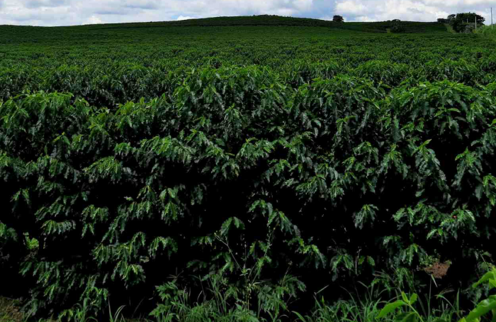




Nidera Sementes presents varieties at Dinetec 2024
The corn cultivars NS 79 (SS2315E VIP3) and NS 89 (SS2322E VIP3) were highlighted; and soy NS7676 IPRO and NS7902 (BW1955231IPRO)
12.01.2024 | 15:37 (UTC -3)
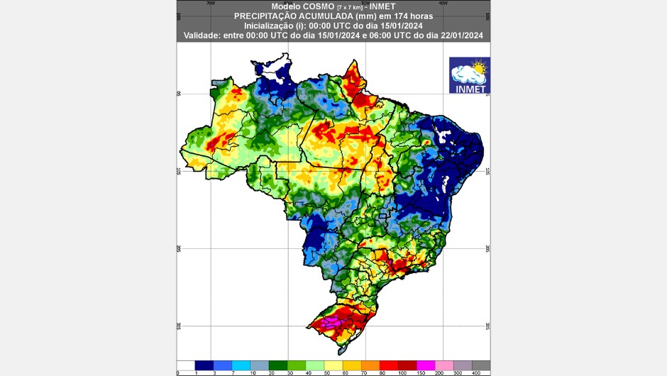
The National Institute of Meteorology (Inmet) concluded today (15.01), the weather forecast for the next two weeks. In the first, between the 15th and 22nd of January, the forecast indicates volumes of rain - which could exceed 70 millimeters (red and pink tones on the map in figure 1 - in a large part of the country, such as in the North Region, part of the Center -West and Southeast, associated with heat and high humidity.
In the interior of the Northeast Region, the forecast is for little rain (blue color on the map in figure 1), however, in Matopiba (an area that covers the states of Maranhão, Tocantins, Piauí and Bahia), there should be rainfall accumulations above 30 mm.
Check out the detailed weather forecast for each region of the country for the next two weeks below.
For Northern Region Rain showers are forecast during the week, with amounts greater than 70 mm in practically the entire region, but mainly in Amazonas, Pará, Amapá and Tocantins, which may be accompanied by lightning, gusts of wind and thunderstorms. In Acre and Rondônia, isolated rain showers cannot be ruled out. In Roraima, lower accumulations are expected (shades in blue).
Na North East Region, the forecast is for rain in the form of showers in areas of Maranhão, Piauí and northwestern Bahia, which could exceed 50 mm and be accompanied by lightning, gusts of wind and thunderstorms. However, isolated rains cannot be ruled out in areas of the states of Ceará, Rio Grande do Norte, Paraíba and Pernambuco throughout the week.
Nas Midwest Regions e Southeast, intense rains are predicted, with volumes that can vary between 100 and 150 mm, which may be accompanied by lightning, gusts of wind and thunderstorms, mainly in the center-north of Mato Grosso, Goiás, São Paulo, Rio de Janeiro, Triângulo and South Minas Gerais. In Espírito Santo, northern Minas Gerais, Mato Grosso do Sul and central-southern Mato Grosso, there is a forecast of rainfall with lower accumulations.
Na South, storms are forecast, due to the action of a low pressure system that will favor strong instabilities between Tuesday and Wednesday in areas of Rio Grande do Sul, which could exceed 150 mm. This instability will affect other areas throughout the week. In Paraná and Santa Catarina, smaller accumulations are expected that could exceed 60,0 mm, however between the 21st and 22nd, there will be a reduction in these accumulated rainfall in the region.
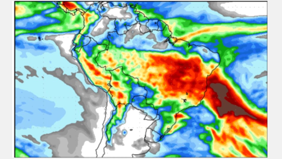
In the second week, between January 23rd and 31st, the forecast indicates significant volumes of rain, greater than 80 millimeters, in the central portion of the country, due to a possible formation of a humidity channel positioned further north of the country, from the Amazon to areas of the Southeast and central-south regions of Bahia. In the northern part of the country, little rain is expected.
For Northern Region volumes greater than 90 mm are predicted in the center-south of Pará and Tocantins. In Acre, south-central Amazonas, northeast Pará, Amapá and Rondônia, lower accumulations are expected. In the northern part of the region, little rain is expected.
In the northern range of North East Region, the forecast is for rain in the form of showers that could exceed 30 mm in the north of Maranhão and Piauí. In Bahia, southern Maranhão and Piauí, Sergipe, Alagoas and Pernambuco, significant volumes exceeding 70 mm are expected.
in the regions Midwest e Southeast locally heavy rain showers are expected to exceed 90 mm.
Na South, the forecast is for accumulated rainfall greater than 60 mm in the region. With a forecast of smaller accumulations in the west of Rio Grande do Sul and Santa Catarina.
Receive the latest agriculture news by email


Receive the latest agriculture news by email